First global indicator-based assessment of all Transboundary River Basins
Now you only need a one stop shop! Transboundary Water Assessment Programme (TWAP)
The TWAP is the first global and quantitative indicator -based assessment of transboundary water systems (aquifers, lakes, rivers, large marine ecosystems and open ocean). It addresses two goals: 1) enabling an evidence-based priority setting process for GEF and other international organizations; and 2) formalising partnerships with key institutions so that transboundary considerations are integrated into regular assessment programmes.

(ESA 2003)

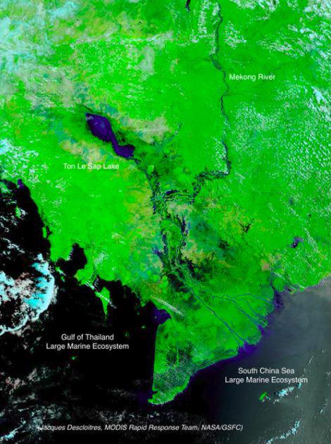
Descloitres,MODIS Rapid Response Team,
NASA/GSFC)
TWAP is poised to help identify core indicators to support national monitoring and reporting of targets required to realize the Sustainable Development Goals for the period 2015 - 2030. TWAP freshwater indicators map to SDG 6 on Clean Water and Sanitation, notably Target 6.6 (protection and restoration of mountains, forests, wetlands, rivers, aquifers and lakes). TWAP marine indicators support SDG 14 on Oceans, Seas and Marine Resources, and all its targets
Below is the global map of risks by theme (rows), and by water category (column). The thematic averages are in the last column, and the water category averages are shown on the last row of each regional set of risk tiles. Southern Asia and Southeastern Asia are the regions most at risk.TWAP is poised to help identify core indicators to support national monitoring and reporting of targets required to realize the Sustainable Development Goals for the period 2015 - 2030. TWAP freshwater indicators map to SDG 6 on Clean Water and Sanitation, notably Target 6.6 (protection and restoration of mountains, forests, wetlands, rivers, aquifers and lakes). TWAP marine indicators support SDG 14 on Oceans, Seas and Marine Resources, and all its targets.

WHAT DOES THE TWAP OFFER?
1. Five water-category specific comparative assessments covering;
- 199 transboundary aquifers and groundwater systems in 43 small island developing states,
- 206 transboundary lakes and reservoirs,
- 286 transboundary river basins;
- 66 large marine ecosystems, and
- The open ocean, for a total of 758 international water systems.
2. Quantitative indicator- based methodology for classifying water systems into five risk categories, from very high to very low risk
3. A crosscutting analysis of the five water systems with a high-level summary of patterns and trends.
4. A Compendium of Water System Information Sheets arranged into 14 TWAP regions and presented as 12 annexes of the crosscutting analysis
5. A Summary for Policy Makers per water category in 6 UN languages.
6. A central data portal with all supporting data and publications (www.geftwap.org) and linking water-category specific websites and databases
- Transboundary Aquifers: http://twapviewer.un-igrac.org
- Transboundary Lakes/ Reservoirs: http://www.ilec.or.jp/en/twap
- Transboundary River Basins: http://twap-rivers.org
- Large Marine Ecosystems: http://onesharedocean.org
- Open Ocean: http://onesharedocean.org
Over the long term, it is envisioned that these baseline assessments will be updated periodically and that the changing states of transboundary waters are better tracked to ensure that the essential ecosystem services they provide are maintained in perpetuity.
For more information on the Transboundary Waters Assessment Programme, go to http://www.geftwap.org to download all the publications and explore the quantitative indicators used in the global assessment. Water system profiles are available at major partner agency links provided in the website.
*This article was originally posted on IWLEARN. Read the original story here.
